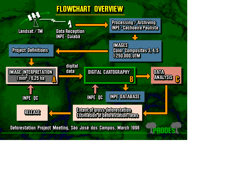
The study required 10,000 machine hours, 10,000 man working hours, 92 technicians and the approximate cost of R$ 1,500,000*. INPE, FUNCATE (Foundation for the Aerospace Science, Applied Research and Technology) and 12 additional companies took part in the project.
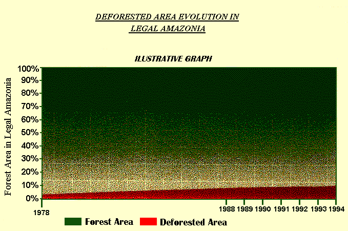
Results have shown an increase of 33% in the average annual deforestation rate. It increased from the 1991 figure of 0.30% to the 1994 0.40%, which corresponds to an annual increment of deforested area of 11,130 km² in 1991 and 14,896 km² in 1994.
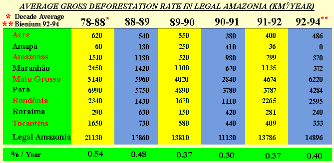
Deforestation has occurred mainly in the states of Pará, Mato Grosso, Rondônia and Acre (Brazilian agricultural border) whereas in the other states (Amazonas, Amapá, Roraima, Maranhão, Tocantins) there has been a decrease in the deforestation activity.
The superposition of deforestation maps to vegetation maps of the areas undergoing a process of undesired settlement clearly indicates that deforestation is advancing in a typical savanna region, that is, it is due to the advance of the agricultural border.
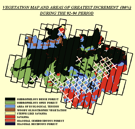
It is important to note that 80% of the total deforestation increment observed involves only 15% of the territory, that is, 750,000 km².
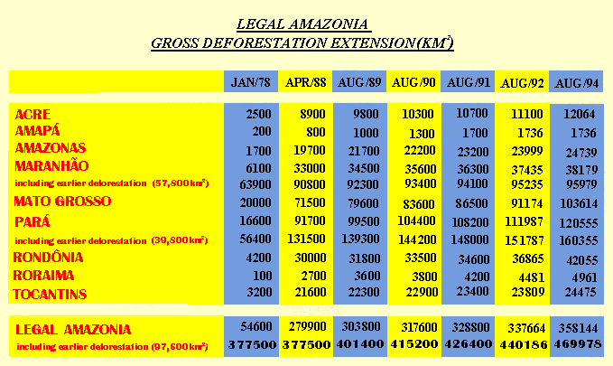
The accumulated rate of the total affected area corresponds to 11.8% of the forest area or 496,978 km².
* US$ 1.00 = R$ 1.055 as March, 1997


